


I walked the Cleveland Way from Whitby to Robin Hood’s Bay on a breezy early autumn day, a classic seven-mile stretch of Yorkshire coast that felt both accessible and satisfyingly wild. I set off from Whitby Abbey’s headland car park under high, fast-moving clouds, with sunshine breaking through just enough to light the North Sea in shifting bands of grey-blue. My plan was simple: walk the cliff-top path south to Robin Hood’s Bay, explore the old village, refuel with a late lunch, then let the bus carry my tired legs back to Whitby.
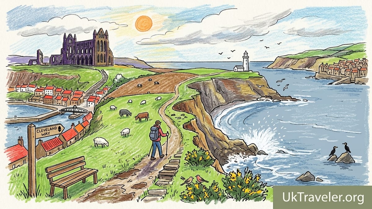
Starting Above Whitby: Abbey, Weather and First Steps
I began at Whitby Abbey car park, a practical and atmospheric starting point. From here the Cleveland Way is clearly signed, and within minutes I was standing by the ruined abbey walls with the whole of Whitby harbour spread out below. The 199 steps up from the old town end just beneath this headland, but beginning at the top avoids an immediate calf-burning climb and lets you ease into the day.
The weather was typical North Sea changeability. A cool westerly wind pushed low clouds inland, leaving the coastal strip alternately sunlit and in shadow. It was around 13 degrees Celsius, with that constant onshore breeze that makes you grateful for a windproof layer even when the forecast looks mild. The ground underfoot leaving the abbey was firm, but I could already see darker, damp patches on the fields ahead that hinted at mud later.
The Cleveland Way heads south from the abbey, keeping you close to the cliff edge but not uncomfortably so. Fences and clear trods keep you a sensible distance from the most unstable bits, though in places the path really does follow the contours of the cliff top. Within ten minutes I could turn back and see the abbey silhouetted against the sky behind me, Whitby’s red roofs spilling down to the harbour and the swing bridge a small line in the middle of it all.
These first few kilometres ease you into the rhythm of the route. The gradient is gentle, with only occasional short rises and dips, and the soundscape quickly shifts from town noise to waves crashing against the cliffs below, punctuated by the metallic cry of gulls circling high above.
Along the Cliffs: Saltwick Bay, Lighthouse and Open Exposure
Beyond the abbey the path soon passes above Saltwick Bay. At lower tide you can often see people exploring the rock platforms below, but from the Cleveland Way you experience it as a sudden widening of the coastline, a curved bite taken out of the cliffs. The sea here looked heavy and steel-blue, with white spray bursting where swells hit the rocks. The wind funneled up the bay and reminded me that this is an exposed route. On a day of strong winds, waterproofs and layers are less about rain and more about wind chill.
The trail surface above Saltwick alternates between compacted earth and short grass, punctuated by stretches of stone or timber steps where erosion or steepness demand it. This is where I first hit noticeable mud. Recent showers had turned shaded sections into slick brown strips, especially near gates and where water naturally pooled. My walking boots coped fine, but anyone in trainers would have spent more time than they liked sliding rather than walking.
Progressing south, the path undulates above the cliffs. There are no big, drawn-out climbs, but there are many small ups and downs that accumulate in the legs. Steps cut into steeper sections help, yet I found myself stopping a couple of times simply to let my breathing settle and to look back. The view north is one of the great pleasures of this walk: Whitby Abbey tiny in the distance, the town now reduced to a thin band of colour between sea and sky.
Eventually the stark white tower of Whitby Lighthouse appears ahead. Reaching it gives a sense of arrival at the walk’s halfway psychological point, even though in miles you are a bit short of that. Here the cliffs feel particularly open, with cropped grass and fewer hedges, so the wind scours across in long, uninterrupted gusts. I tightened my pack straps and was glad of a hat that would not blow off.
Mud, Gradients and Wildlife on a Working Coast
From the lighthouse onwards, the terrain tells you this is a lived-in landscape as well as a recreational one. The path threads between fields where cattle and sheep graze, and I stepped aside for a quad bike buzzing along a farm track inland. That mix of wild coast and working farmland is part of the Cleveland Way’s character, and you share gates and stiles with the people whose land you cross.
The gradients here become more repetitive. The official route is around 6.8 to 7 miles between Whitby and Robin Hood’s Bay, and although no single climb is long, the constant up and down means you work for your progress. I tracked my day: just under 3 hours 20 minutes of actual walking time plus about 40 minutes of pauses for photographs, water and a longer coffee break above one of the inlets. In total it took me around 4 hours from abbey car park to the top of Robin Hood’s Bay village.
Wildlife felt more about sound than spectacle. I walked outside the main nesting season, so cliffs that would be crowded with seabirds in high summer were relatively quiet. Instead, I noticed skylarks rising from the rougher field edges inland, and small flocks of finches flitting between gorse bushes. Offshore, a couple of cormorants alternated between low skimming flights and statuesque drying poses on the rocks far below. It was a reminder that this coast can be dramatic without always putting on a show.
The mud remained a running theme. Shaded pockets on north-facing slopes and the bottoms of small dips held water, turning parts of the path into shallow, boot-deep bogs. In several spots the trail had been subtly diverted inland behind fencing where erosion was worst, leaving old, cracked former lines closer to the cliff edge visible but obviously out of use. It felt secure underfoot provided I respected the waymarks and stayed behind barriers wherever they existed.
Coastal Erosion and the Ravenscar Beach Access Closure
Walking this stretch, it is impossible not to notice how actively the sea is reshaping the land. Sections of the cliff show fresh scars and slumps, and warning signs remind you that edges can be undercut. The Cleveland Way itself is managed with this in mind; there are fences, occasional short re-routes and advisory signs where the edge is unstable. On my walk there were no closures between Whitby and Robin Hood’s Bay, but I could see where recent erosion had narrowed older trods and prompted path work slightly further inland.
Further down the coast, at Ravenscar, the risk becomes very concrete. The long, steep footpath from Ravenscar’s golf course area down to the beach has been closed following landslips that damaged the route and made it unsafe. Public notices confirm that this closure also cuts off any practical way of getting back up from the foreshore beneath Old Peak, so anyone trying to reach Ravenscar along the beach from Robin Hood’s Bay or Boggle Hole currently finds no legal or safe exit up the cliffs there.
This matters for planning if you are piecing together longer itineraries that link beach walking with cliff-top sections, but it does not mean the Cleveland Way itself between Whitby and Robin Hood’s Bay is closed. That main cliff-top trail remains open and clearly signed. The key message is to stay on the official route, respect temporary diversions if they appear, and avoid improvising your own shortcuts near the cliff edge or down unstable slopes.
As I walked, seeing broken fences hanging over fresh slips drove that home more forcefully than any warning sign could. The sea will win every argument in the long term. My part, as a visitor, was simply to tread where the National Trail markers told me it was safe to do so.
Arriving at Robin Hood’s Bay: Descent, Cobbles and a Well-Earned Meal
The first glimpse of Robin Hood’s Bay from the Cleveland Way is a satisfying moment. The cliffs to the south fold inward to reveal a wide arc of shoreline, and the clustered stone houses of the old village appear huddled at the water’s edge. From a distance, the steepness of the final descent is not obvious. That revelation comes later.
The Cleveland Way feeds you onto the road near the top of the modern village, close to car parks and bus stops. After hours of soft earth and grass, the sudden feel of tarmac underfoot is striking. From here you follow New Road, a famously steep and narrow lane that winds down to the harbour. The gradient is serious enough that I instinctively shortened my stride to protect my knees, and I was glad to have walking poles to steady myself on the cobbles, though they are not essential if you are confident on steep ground.
The old village felt busy but not overwhelmed on my visit, with a mix of day walkers, families on the beach and a few multi-day backpackers finishing or starting longer routes. After pausing to watch the waves lap against the sea wall and children hunting for crabs in the rock pools, I ducked into the lower village streets in search of food. I ended up at a café near the bottom, where I ordered fish and chips and a large mug of tea. Portions were generous, prices in line with what you would expect in a popular coastal village, and, most importantly after a windy walk, it was somewhere warm to sit for half an hour.
That pause changed how I felt about the day. Fatigue had been creeping into my legs on the last undulations before the village, but a proper meal and a seat turned my mood from “I am done” to “I could happily wander these lanes for another hour.” I spent some time exploring the tangle of alleys and steps behind the seafront, where houses rise in layers above one another, before beginning the climb back up to the bus stop on Thorpe Lane at the top of the hill.
Returning by Bus and Practicalities: Parking, Time and Effort
For my walk I had parked in Whitby, near the centre, and planned it as a one-way route to Robin Hood’s Bay with a bus journey back. Several long-stay car parks around the marina and station offer all-day tickets, with prices that reflect Whitby’s popularity but remain competitive for a full day’s walking and sightseeing. Starting from town or the abbey makes sense if you want straightforward logistics and easy access to facilities before and after the walk.
From Robin Hood’s Bay, the Arriva-operated X93 and X94 buses link the village with Whitby and Scarborough along the A171. At the time of my visit there were regular daytime services, typically around hourly or better in the main part of the day between the stop at the top of the bank in Robin Hood’s Bay and Whitby bus station. The journey back to Whitby took around 20 minutes. I bought my ticket from the driver and did not need to pre-book.
In terms of timing, if you allow three and a half to four hours for the walk itself, plus at least an hour in Robin Hood’s Bay for exploring and food, a day visitor who starts walking from Whitby between 9 and 10 in the morning has ample time to complete the route, relax in the village and catch a mid to late afternoon bus back. Those staying locally can stretch the day out more luxuriously, perhaps adding a short beach wander if the tide is suitable.
Accommodation options exist at both ends. Whitby offers hotels, guesthouses and self-catering lets in almost every price band. Robin Hood’s Bay, though smaller, has a good selection of B&Bs and holiday cottages both in the old village and on the cliff top. For anyone wanting to turn the walk into an overnight mini-break, staying in the Bay and walking back via the Cinder Track or a bus the following day is entirely realistic.
Cleveland Way vs Cinder Track: Two Very Different Corridors
One of the interesting features of this stretch of coast is the presence of a second long-distance route running roughly parallel inland: the Cinder Track. This multi-use trail follows the old Scarborough to Whitby railway line between the two towns, linking with both the Cleveland Way and local paths at several points, including Robin Hood’s Bay and Whitby.
Between Whitby and Robin Hood’s Bay the difference in character between the two routes is marked. The Cleveland Way is an undulating cliff-top footpath, narrow in places, with flights of steps and short, sharp rises and descents. Underfoot you have grass, compacted soil, some sections improved with stone, and, in wet spells, plenty of mud. In exchange for that effort you get huge open views of sea and sky, and the constant presence of the coastline close at hand.
The Cinder Track, by contrast, sits further inland on the old railway alignment. It climbs steadily out of Whitby and then rolls gently towards Robin Hood’s Bay, its gradients softened by the engineering of the original line. For walkers it is easier in terms of ascent and descent, though the surface is more mixed than the name suggests. Some sections are a reasonably smooth compacted path, while others between Whitby and Robin Hood’s Bay have rougher, stonier patches where the original cinder and ballast have become exposed. Cyclists, families with buggies and dog walkers still use it heavily, but hybrid or mountain bikes cope better than road tyres.
Scenery on the Cinder Track has a different feel. You still glimpse the sea, but often framed by trees, hedges or the backs of fields rather than sheer cliffs dropping at your elbow. Former railway structures such as cuttings, embankments and, nearer Whitby, the impressive Larpool Viaduct give the route historical interest. It lacks the airy drama of the Cleveland Way yet offers more shelter from wind on blustery days, and in wet or icy conditions it can be a safer alternative to slippery cliff steps.
Fatigue, Crowds and Weather: A Candid Look at the Experience
Despite its modest distance, the Whitby to Robin Hood’s Bay section of the Cleveland Way is not simply a flat seaside stroll. By the final couple of miles my legs knew they had been working. The repeated short climbs, particularly as you approach the undulating ground before the Bay, add up to something that feels more substantial than the numbers suggest. I was fine walking at a steady pace with occasional short breathers, but I would not describe it as an effortless outing for very inexperienced walkers.
Crowds were a factor too. Close to Whitby, especially near the abbey and around Saltwick Bay, the path was busy with casual strollers and groups. The further south I went, the thinner the numbers became, but I was almost never alone for long. This is a famous stretch of coast and it attracts coach parties, families and individual day walkers in just about every dry-weather spell outside the depths of winter. The atmosphere was friendly, yet anyone seeking solitude might prefer to start early, walk outside school holidays or explore less well-known sections of the Cleveland Way elsewhere.
Weather has the potential to make or break the day. My mix of wind and scattered sun felt quintessentially North York Moors coast: dynamic and invigorating. On another trip along part of this route in thicker sea mist, I have seen the visibility drop to a few dozen metres, entirely erasing the sea views that are the main selling point of the walk. In those conditions the path remains navigable but the experience is very different. The cliffs are still there, the surf still roaring below, but your world shrinks to the fence line, the next waymark and the feel of damp air on your face.
Being candid, there were stretches where the mud and the headwind made me question my enthusiasm. Yet reaching the first full view of Robin Hood’s Bay and later standing in the jumble of its old streets, looking back along the cliffs I had just walked, easily justified the effort. It felt like a complete day out rather than a token amble.
The Takeaway
Looking back on the walk, my favourite section was the run between Whitby Lighthouse and the first proper sight of Robin Hood’s Bay. Here the coast feels open and elemental. The cliffs drop cleanly to the sea, fields sweep away inland, and you are far enough from both towns that the only reminders of human presence are the odd farm building, the path itself and the line of the old railway further back. On a day of shifting light you can watch weather working across the water and along the shore in real time.
For an ideal break point, I would aim to pause roughly halfway, somewhere near the open fields beyond the lighthouse where low cliffs allow you to sit safely and watch the surf below. This is a good place to take on food, adjust layers and decide whether to linger or press on at pace. Factoring in that kind of pause helps keep the final approach to Robin Hood’s Bay enjoyable rather than a tired march toward the promise of a café chair.
As for whether Robin Hood’s Bay deserves an overnight stay, I came away convinced that it does. Arriving after a walk concentrates your attention on immediate comforts, but once those are satisfied the village repays slower exploration. Staying the night would let you experience the streets and beach at quieter times, particularly early morning or evening when most day visitors have gone. It also opens up options for a second day on the Cinder Track, a shorter circular walk to Boggle Hole if tides and access allow, or simply a leisurely bus ride back to Whitby with no timetable pressure.
If you have one clear, breezy day on the Yorkshire coast and a reasonable level of fitness, walking the Cleveland Way from Whitby to Robin Hood’s Bay with a bus back offers a near-perfect balance of logistics, scenery and satisfaction. Accept the mud, pack for wind, and give yourself time both on the cliffs and among the cobbles of the Bay, and it will feel like far more than a simple seven-mile outing.
FAQ
Q1. How long does it take to walk from Whitby to Robin Hood’s Bay on the Cleveland Way?
Most walkers take around three to three and a half hours of actual walking time, plus extra for breaks, photographs and exploring Robin Hood’s Bay.
Q2. How far is the walk and how difficult is it?
The route is roughly 6.5 to 7 miles one way. It is moderate rather than easy, with many short ascents and descents and some muddy or stepped sections.
Q3. Where does the walk start in Whitby?
A popular starting point is Whitby Abbey car park on the headland above the town, where you can join the clearly signed Cleveland Way heading south along the cliffs.
Q4. Is the path close to the cliff edge and is it safe?
The Cleveland Way stays a sensible distance back from the most unstable edges and often has fencing, but you are on top of real sea cliffs, so it is important to keep to the marked path.
Q5. Are there buses between Robin Hood’s Bay and Whitby?
Yes, Arriva-operated services such as the X93 and X94 run between Robin Hood’s Bay and Whitby along the main road, with regular daytime departures and a journey of about 20 minutes.
Q6. What is the difference between the Cleveland Way and the Cinder Track?
The Cleveland Way is a cliff-top footpath with big sea views and steeper ups and downs. The Cinder Track is an inland rail trail with gentler gradients and a firmer, if sometimes rough, surface.
Q7. Is coastal erosion affecting this walk?
Coastal erosion is active along this stretch and has led to some diversions and fencing, but at present the main Cleveland Way between Whitby and Robin Hood’s Bay remains open on its official line.
Q8. What about the Ravenscar beach access closure I have heard about?
The steep footpath down to the beach at Ravenscar is currently closed due to landslips and there is no safe way up from the foreshore there, but this does not close the Whitby to Robin Hood’s Bay cliff-top route.
Q9. Do I need special gear for this walk?
Sturdy footwear that can handle mud, a windproof or waterproof layer, water, snacks and optional walking poles are usually enough for most reasonably fit walkers in normal conditions.
Q10. Is Robin Hood’s Bay worth staying in overnight?
Yes. Staying allows you to enjoy the old village and beach when day-tripper numbers drop, and makes it easy to explore the Cinder Track or shorter local walks the following day.