


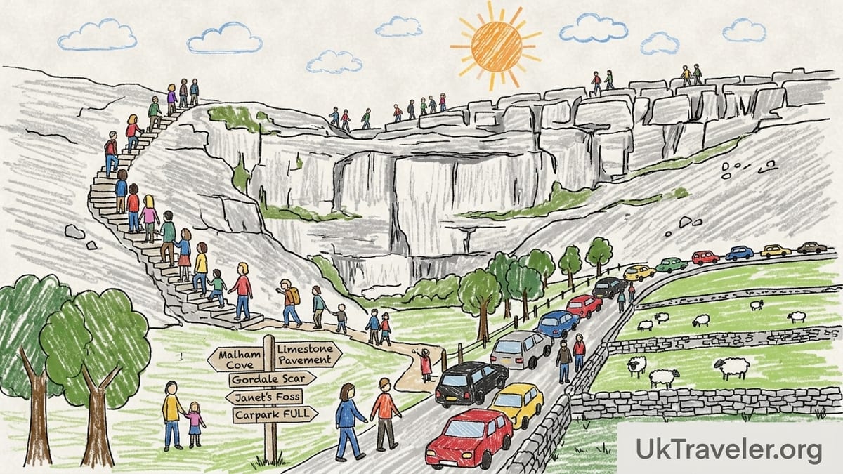
On Saturday 19 September 2026 I drove into Malham with the blithe confidence of someone who has read too many pretty blog posts and not enough small print. The forecast promised dry, overcast weather with showers later, around 14°C. It sounded ideal. By 9.45 a.m. the reality was already biting: the main National Park car park was close to full, a queue of cars idled on the lane, the verges towards Kirkby Malham were scarred with tyre tracks, and the supposedly straightforward Malham Cove and Gordale Scar circuit was already heaving with people. What followed convinced me that the crowds, the parking situation and the genuine difficulty of parts of this route are routinely and seriously underestimated.
Setting Out: Expectations Versus Reality in Malham
I arrived in Malham expecting a classic Yorkshire Dales outing: a three to four hour loop taking in Malham Cove, the limestone pavement, Gordale Scar, Janet’s Foss and back to the village. Guidebooks and glossy blogs had sold it as a perfect family-friendly circuit with “a few steep sections” and “easy scrambles.” The impression was of a rural theme park, busy but benign, with parking “available at the National Park car park.” None of the sources I checked beforehand properly prepared me for what a late-morning arrival on a dry Saturday in September is actually like.
The Yorkshire Dales National Park Authority itself is far more candid. Its visitor guidance explicitly warns that car parks in the south of the park, especially Malham and Horton in Ribblesdale, fill up early and quickly, and suggests considering other areas if you arrive later in the day. It also stresses that roadside parking can block emergency access. That sober warning is in stark contrast to the breezy tone of many walking websites that mention Malham’s parking almost as an afterthought rather than the first hurdle you will face.
By the time I pulled into the access road to the visitor centre car park shortly before 10 a.m., stewards were already directing drivers to tighter and tighter spaces. A handful of remaining bays were being fought over by cars circling slowly. Behind me, a growing tailback started to spill out past the National Park signs. For a walk that I had seen casually billed as a “short half day in the Dales,” the logistics alone were starting to feel like a full-contact sport.
Even at this hour the village felt saturated. Clusters of families queued for the toilets beside the National Park Centre. A school group was being briefed by staff under the trees. The narrow lane towards the Cove boiled with a constant stream of people in trainers, pushchairs, dogs on extendable leads, and serious hikers threading between them. The romantic idea of a quiet ramble had already dissolved before I reached the first field gate.
Busiest Car Park in the Dales: What Happens When You Arrive Late
In practice, many visitors do not arrive by 9 or 10 a.m. They turn up closer to midday and are taken by surprise when they find Malham’s main car park already full or very close to it. Yorkshire Dales National Park’s own information highlights Malham as one of its busiest parking locations and explicitly notes that southern car parks fill early. When those spaces go, the problems ripple out quickly.
On my visit, by around 11.30 a.m., the overflow effect was obvious. Cars that had been turned away or deterred by the queue were now inching back out towards Kirkby Malham looking for somewhere, anywhere, to leave their vehicles. Some managed to squeeze into legitimate laybys. Others simply gave up and began edging onto grass verges, or tucking two wheels into shallow ditches on narrow lanes. In several spots I saw vehicles partially blocking passing places, despite double yellow lines and “No parking” signs.
This is not just inconsiderate. A traffic management report for Malham has documented drivers parking where it is explicitly prohibited, including along Kirkby Brow and on unsuitable narrow streets such as Finkle Street, once the main car park is saturated. Local authorities and the National Park have warned that such verge and roadside parking risks preventing emergency vehicles from getting through. I stood at one constricted section and tried to imagine a fire engine or ambulance squeezing past the double row of parked cars. It would not have been easy.
There is also a personal cost. If you park a kilometre or more out of the village, your “easy three mile stroll” lengthens dramatically. What is advertised as a family friendly route swells by an extra half hour or more of road walking at the start or end, often with children who are already tired. I watched one family trudging the lane back towards a distant car, the youngest slumped and sobbing, the parents silent. For them the experience was now less about limestone wonders and more about sheer fatigue.
Short Stroll or Stone Staircase: The Truth About Reaching Malham Cove
Malham’s most famous feature is Malham Cove itself, a towering limestone amphitheatre whose sheer cliffs dominate the valley. Almost every visitor at least walks to its base, and here it is true that the path is comparatively easy. From the National Park car park, the riverside track is well made and almost flat, with stone flags across boggier sections. It is busy but broadly manageable for most abilities, and on my visit I saw wheelchairs and buggies making good progress along this lower section before the terrain steepens.
Standing at the base of the Cove, surrounded by dozens of people angling for photos, it is tempting to accept the casual phrase you see in many guides: “climb the steps to the top.” What is rarely spelled out with any clarity is that this involves roughly 400 stone steps, uneven in height and spacing, climbing steeply to the limestone pavement above. For many casual visitors who have come in trainers and jeans, often after a long drive, this is a far more strenuous ascent than they expect.
I decided to tackle the steps as part of the full circuit. Within minutes my legs were burning. The staircase twists up the side of the Cove, often narrow enough that you must wait for people descending, and on a busy weekend the human traffic jams are constant. I passed a dozen people stopped for breath on the lower half alone, some clinging to the handrail, others standing on the worn earth at the side waiting for children to catch up. There were no dramatic incidents, only a sense that this “simple climb” was quietly humbling a lot of visitors.
At the top, the rewards are undeniable. The limestone pavement stretches out like a giant, weathered chessboard, with clints and grykes creating an alien landscape that has made cameo appearances in films and television. On my visit the rock was mostly dry but slick in places where countless boots had polished the surface. Families posed in the grykes; teenagers hopped between blocks. A light shower blew in and suddenly the limestone darkened and the grip deteriorated noticeably. Several people near me slipped, arms pinwheeling, although fortunately no one fell badly. It brought home how quickly this terrain can shift from playful to precarious when the weather turns.
Gordale Scar: Looking In Versus Scrambling In
From Malham Cove I followed the high path towards Gordale Scar, crossing fields before dropping into the limestone gorge. This is another point where guidance often blurs the line between sightseeing and genuine scrambling. Descriptions that read “continue into the Scar, scrambling beside the waterfall” can give the impression of a slightly bumpy path. The reality, especially in wet conditions, is that the route beyond the first view of Gordale is significantly more demanding than many visitors expect.
Reaching the entrance itself is straightforward. A broad, well trodden track from the road leads into the narrowing gorge, with cliffs rearing up dramatically on either side. On my visit I could see why Gordale is so heavily photographed: even from the mouth of the scar, the scale of the limestone walls and the sound of water echoing off them were astonishing. Children paddled in the stream; dogs chased sticks; a mobile catering van in the layby outside had attracted a queue for coffees and ice creams.
The shift comes when you move beyond that first viewpoint and try to press deeper into the gorge. Here the “path” becomes a series of wet limestone ledges, angled slabs and boulders. In September, the water flow was moderate but constant, and the rock where the main route passes up beside the lower waterfall was unequivocally slippery. I watched several parties start up, freeze, then inch back down on their backsides. One man in smooth soled fashion trainers slid half a metre and only just caught himself on a protruding rock.
Scrambling up this section in dry weather with appropriate footwear, a light pack and some experience is a rewarding little adventure. Attempting it when the rock is wet, with young children, dogs on leads, or heavy rucksacks, is another matter entirely. On my own ascent I placed hands and feet carefully, testing each hold. The flow from the falls soaked the central line and I chose a drier variant to the side, but even there the polished rock demanded full concentration. The idea that this is a “family friendly shortcut” to Malham Tarn, routinely suggested in online guides, feels cavalier when you are standing on slick limestone with a stream running at your heels.
Mud, Limestone and Fatigue: How the Circuit Really Feels Underfoot
Descriptions of the Malham circuit often flatten its character under vague phrases such as “good paths throughout” or “some rocky sections.” Walking it end to end, with a modest level of fitness but carrying camera gear and wet weather clothing, I found the cumulative effect of mixed terrain, crowds and changing weather considerably more taxing than advertised.
Between Malham Cove and Gordale Scar, the higher field paths had turned to mud in several gateways, churned by livestock and hundreds of boots. In dry spells these sections may be dusty and firm, but after even modest rain they become greasy slides. I watched several people in smooth soled trainers go down on their backsides. One couple spent five minutes trying to coax a muddy pushchair through a stile that was simply not designed for it. None of this is surprising in farmland, yet pre trip materials rarely acknowledge quite how messy and awkward these interludes can be.
By the time I had climbed the Cove steps, crossed the limestone pavement, negotiated the muddy fields and scrambled into Gordale Scar, fatigue was unquestionably a factor. The rock demanded precision, yet my legs were no longer fresh. A brief shower halfway through the day turned the already slick limestone in the gorge into something close to soap in places. Concentration, rather than physical strength alone, became the limiting factor. It is this combination of cumulative tiredness and increasingly technical ground that so many breezy route descriptions omit.
On the final leg, dropping from Gordale back towards Janet’s Foss and the wooded path into Malham, the human density peaked again. The narrow paths funneled returning walkers against those still heading out. Tired children stumbled; dogs tangled leads around ankles; people stopped abruptly to take photos of Janet’s Foss waterfall, creating concertina effects in both directions. The last kilometre into the village felt less like a rural walk and more like shuffling towards the exit of a music festival.
The Problem With “Bundle Everything” Route Guides
One of my strongest impressions from this visit is how many guides and promotional pieces treat Malham Cove, Gordale Scar, Janet’s Foss and Malham Tarn as interchangeable pick and mix attractions, bundling them into a single recommended day out without clearly stating distance, ascent and terrain. Plenty of websites offer variations of a “classic Malham circular” that link all four, sometimes suggesting extensions to Malham Tarn and back across the moor, yet bury the hard numbers in small print, if they appear at all.
In contrast, official resources and more responsible walking sites tend to be clearer. Routes published by the Yorkshire Dales National Park and established walking platforms usually give at least approximate distances, ascent and a terrain summary. A common Malham Cove and Gordale Scar circuit that includes Janet’s Foss but not Malham Tarn comes in somewhere around 7 to 8 kilometres with a significant amount of ascent, including the 400 stone steps and the scramble if you choose to tackle it. Adding Malham Tarn can push the outing closer to 10 to 12 kilometres and require more sustained climbing.
Where problems arise is when shorter descriptions downplay those details with phrases like “ideal half day” or “gentle family walk,” without emphasising that the gentler alternatives usually stop either at the base of Malham Cove or at the mouth of Gordale Scar. Nowhere in those breezier summaries did I see a bold statement along the lines of: “Beyond this point, the route involves steep stone steps and potentially hazardous scrambling on wet limestone.” Yet that is precisely the message that would have helped many people I saw that day make more informed decisions.
This lack of clarity matters. On my circuit I met several visitors who had set out expecting two or three comfortable hours and instead found themselves three quarters of the way into a demanding loop, already tired, with the most technical sections still ahead. One family turned back below the Gordale scramble after realising how steep and wet the rocks were. Another group, who had been aiming for Malham Tarn as well, abandoned that plan at the top of the Cove, daunted by the unexpected effort of the steps. Honest labelling and unambiguous breakdown of options would not deter capable walkers, but it would give others a chance to tailor their day more safely.
Parking, Facilities and DalesBus: What I Observed
In fairness, Malham is better served with facilities than many rural honeypots. The National Park car park beside the visitor centre in the village provides pay and display parking, toilets and staffed information during opening hours. National Park guidance confirms that at Malham and other key sites you can pay by cash for parking inside the visitor centre when it is open, a practical detail that matters for those who arrive without coins or with unreliable mobile signal for card or app payments.
On my visit the toilets were heavily used but functioning, with queues building late morning. Staff at the visitor centre fielded a steady stream of questions about route options, waterfalls and the condition of the steps and scramble that day. Official car park and toilet listings from the park authority underline that Malham is one of a network of managed sites, but again stress that at busy times they fill early and that roadside parking can be dangerous as well as illegal in places.
As an alternative to driving and wrestling with parking, DalesBus deserves more attention than it typically gets in mainstream walking write ups. This network, coordinated by a community interest company, links towns such as Skipton and Keighley with Malham and other Dales villages. In 2026, routes such as the 75 between Skipton and Malham and Sunday and seasonal services under the 866 and related DalesBus numbers provide regular links to the village, supported by a national cap on most English bus fares that currently keeps single tickets at around 3 pounds.
However, taking the bus does not remove the need for planning. Weekend and seasonal services to Malham do not run every few minutes; they can be spaced by several hours, and winter timetables in particular are thinner than summer ones. On the day I visited, the afternoon departure back towards Skipton was busy but not overloaded, with walkers clearly timing their return to fit the bus schedule. If you rely on public transport, you must be prepared to match your route length and ambition to the last bus of the day rather than to your car keys in a nearby car park.
Two Hours, Half a Day or Longer: Choosing the Right Malham Experience
Having walked the full Malham Cove, Gordale Scar and Janet’s Foss loop myself, I would now divide realistic visitor options into three categories: a focused two hour visit, a half day circuit, and a longer, more strenuous route that might include Malham Tarn or extended moorland sections.
The two hour visit suits those who want impact without over commitment. From the National Park car park you can walk the level path to the base of Malham Cove, spend time appreciating the amphitheatre, then either return the same way or add a short diversion towards Janet’s Foss without taking on the Cove steps or the Gordale scramble. On my visit, people who confined themselves to this lower valley section still had a rich experience: close views of the cliffs, riverbank scenery, and manageable paths, all within striking distance of facilities in the village.
The half day circuit, which is what many guides gesture towards, is the one I actually walked: up the stone steps to the top of Malham Cove, across the limestone pavement, via field paths to Gordale Scar, into the gorge as far as each person is comfortable, then back via Janet’s Foss to Malham. Done at a steady but not rushed pace with pauses for photos and snacks, it filled around four and a half hours for me in mixed conditions. The ascents, mud and scramble sections made it tiring but satisfying. For reasonably fit adults with appropriate footwear and realistic expectations, this is an excellent outing. For inexperienced walkers or those uncomfortable with steep steps and exposure, it is closer to the upper edge of what they might enjoy.
The longer route takes that same core and adds Malham Tarn and additional ascent on rougher terrain. To complete this comfortably you need not only good fitness but also more experience in route finding and coping with changing weather. On my September day, low cloud had started to hang over the higher ground by early afternoon and showers were drifting through. Having already felt the cumulative effort of the circuit so far, I was glad I had not committed to the tarn extension. Several people I spoke to at the top of the Cove admitted reconsidering their plans once they realised how the steps alone had eaten into their energy.
The Takeaway
If I return to Malham, I will plan the day very differently. I would aim to arrive at or before 8.30 a.m., not only to secure parking in the National Park car park but also to experience the valley and the Cove with fewer people on the paths. I would repeat the half day circuit that I actually walked, including the climb up the stone steps and a cautious foray into Gordale Scar, but I would reserve that scramble section for dry conditions and ensure I had firm soled footwear and a lighter pack.
For first time visitors with limited walking experience, my recommendation is clear. Enjoy the level walk from the village to the base of Malham Cove and perhaps the riverside and woodland paths to Janet’s Foss, but treat both the 400 step climb to the limestone pavement and the scramble inside Gordale Scar as optional extras rather than default parts of the route. If in doubt, walk to the viewpoints, assess how the ground and water look on the day, and do not be swayed by guidebook bravado.
I would also place far more emphasis on public transport and timing. Checking current DalesBus and Keighley Bus Company timetables from hubs like Skipton in advance, and planning the walk around those fixed departure times, can remove the parking stress entirely. The trade off is less spontaneity; miss the last bus and you are stranded. But on busy weekends, the relief of stepping onto a bus at the end of a long walk instead of fighting back out through narrow lanes studded with badly parked cars is not to be underestimated.
The real problem in Malham is not that the landscape is too challenging or that it attracts crowds. It is that much of the popular information smooths out the rough edges, underplays the pressure on parking and paths, and treats serious features like the Cove steps and the Gordale scramble as casual add ons. My day on the ground showed a more complicated picture: a spectacular corner of the Dales where preparation, footwear, timing and honesty about your limits matter very much. Go, by all means, but go early, go informed and do not let wishful thinking turn a memorable day into a miserable one.
FAQ
Q1. Is the walk from Malham village to the base of Malham Cove suitable for beginners?
The riverside path from the National Park car park to the base of Malham Cove is relatively level and well surfaced, and many beginners manage it comfortably in good weather. The challenges begin if you add the steep stone steps to the top or combine the route with Gordale Scar.
Q2. How many steps are there up the side of Malham Cove, and how hard are they?
The main staircase up the side of Malham Cove involves roughly 400 uneven stone steps. The ascent is steep and sustained, and on busy days you may be forced to stop and start as you wait for others, which makes it feel harder than a normal hill walk.
Q3. Do I need special equipment to go into Gordale Scar?
You do not need ropes or technical climbing gear to explore the entrance of Gordale Scar, but if you plan to scramble deeper beside the waterfall you should at least have sturdy footwear with good grip and be confident placing hands and feet on wet rock. In wet or icy conditions many people sensibly turn back.
Q4. How early should I arrive to find parking in Malham on a weekend?
On busy Saturdays and Sundays in the main season, arriving before 9 a.m. greatly increases your chances of finding a space in the National Park car park. The park authority itself warns that Malham is one of its busiest sites and that car parks can fill early, so treating late morning as a safe arrival time is risky.
Q5. Is DalesBus a reliable alternative to driving to Malham?
DalesBus services from hubs like Skipton and Keighley provide a good alternative to driving and avoid parking stress, but they run to fixed timetables that can be several hours apart, especially in winter. It is important to check current schedules and plan your walk so you are back in the village well before the last bus.
Q6. Can children manage the full Malham Cove, Gordale Scar and Janet’s Foss circuit?
Many families do complete the loop, but it is longer and more strenuous than some guides suggest, especially if you include the Cove steps and the Gordale scramble. For younger children or those not used to hill walking, limiting the day to the base of Malham Cove and Janet’s Foss is often a happier experience.
Q7. Are there toilets and other facilities on the route itself?
Toilets, information and parking are concentrated at the National Park Centre in Malham village. Once you leave the village there are no official toilets at Malham Cove, Gordale Scar or on the field paths, so you need to plan accordingly and follow outdoor toileting best practice if caught short.
Q8. What footwear is appropriate for the Malham circuit?
Given the mix of stone steps, mud, fields and limestone slabs, footwear with a firm sole and good grip is strongly recommended. On my visit I saw several slips from people in smooth soled casual trainers, especially on wet limestone near the waterfalls and in muddy gateways.
Q9. Is there an easier way to experience Gordale Scar without scrambling?
Yes. You can walk the track from the road into the mouth of Gordale Scar and enjoy impressive views of the cliffs and waterfalls without climbing the wet rocks. Many visitors stop at this viewpoint and then return to the main path or continue via the road and field paths instead of scrambling.
Q10. Which parts of the Malham area would you advise inexperienced walkers to avoid?
Inexperienced walkers are usually best avoiding the scramble inside Gordale Scar beyond the main viewpoint, especially in wet conditions, and thinking carefully before committing to the full staircase up Malham Cove. Sticking to the valley paths, the base of the Cove and the approach to Janet’s Foss provides plenty of scenery without unnecessary risk.