


I arrived in Horton-in-Ribblesdale on a grey June morning with more nerves than bravado, fully aware that the Yorkshire Three Peaks is not just a pretty day out. It is a 24 mile, roughly 38.6 kilometre circuit over Pen-y-ghent, Whernside and Ingleborough, with around 1,600 metres of ascent and a widely quoted 12 hour target. What follows is a frank account of how it actually felt, what I got right and wrong, and why I finished the day with a greater respect for the route than for any finish time.
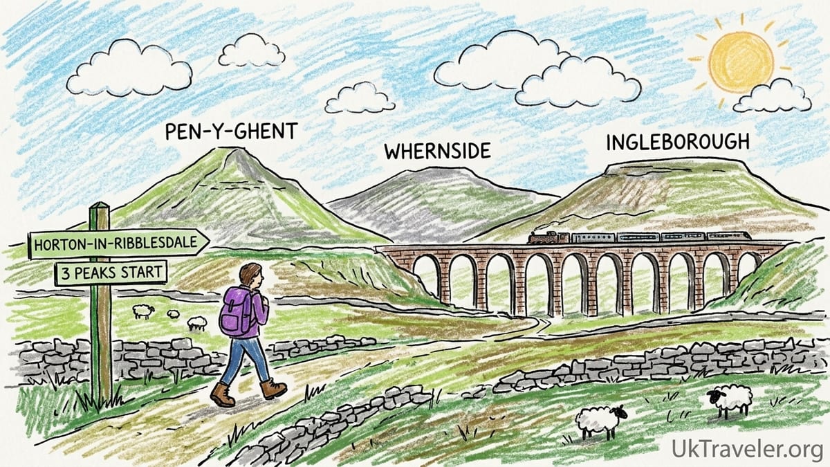
Arriving In Horton-in-Ribblesdale: The Start Of A Long Day
I made my attempt on Saturday 20 June 2026. The previous evening I had checked in at the 3 Peaks Bunkroom in Horton-in-Ribblesdale, a no-nonsense bunkhouse geared almost entirely towards walkers. In June 2026, their weekend rates were advertised at about £130 per night for a six bed en suite room and £160 for an eight bed room, prices that make sense if you are sharing with a group and want to be a five minute stroll from the start of the route.
Horton itself is a small Dales village surrounded by limestone scars and grazing fields, with the railway station on the Settle to Carlisle line and a couple of pubs that fill rapidly on Friday nights. By the time I had eaten a plain pub pasta, laid out my kit and tried to sleep, the reality was sinking in. This was not a casual wander. The official Yorkshire Dales National Park description calls it a “major challenge walk” of about 24 miles with over 1,600 metres of ascent, warning that tiredness and poor weather combine quickly at this distance.
I set out from the main National Park car park in Horton at 6:05 a.m. The cloud base hovered just above the village, but visibility was reasonable and the forecast mentioned showers rather than storms. It was roughly 10 degrees Celsius, that awkward British combination of cool in the shade and sweaty under a waterproof. I noted my intention to walk clockwise, taking Pen-y-ghent first, then Whernside, then Ingleborough, and I accepted something important: if my body or the weather deteriorated, I would cut it short, twelve hour target or not.
From the very first few hundred metres through the fields out of Horton, passing an early group being briefed by a professional guide in branded waterproofs, I could feel a split between those treating it as a race and those, like me, quietly focused on simply getting round in one piece.
Pen-y-ghent: A Shock To The System
The opening miles to Pen-y-ghent are deceptive. The track begins gently, along a minor road and then on to a well built path that heads up towards the pyramid-like bulk of the hill. The official route notes describe a straightforward path followed by a short section of steep rocky ground to reach the summit, and that matches what my legs experienced. The path steepens as you swing left towards the craggy upper slopes and the comforting murmur of walkers chatting begins to fragment into laboured breathing.
I reached the summit trig point of Pen-y-ghent at 7:15 a.m., about 1 hour 10 minutes from Horton. It felt fast to me, yet I was already being passed by fitter walkers who had started later. The wind here was much stronger than in the village, perhaps gusting around 25 to 30 miles per hour, enough to make walking near the edge of the path require attention. Low cloud skimmed over the plateau, leaving half the summit in milky mist and making the rocks slick underfoot. I pulled on a light insulated jacket and a hat, the first reminder that the National Park’s advice about carrying proper layers is not theoretical, even in June.
I had planned to be disciplined with food and water. Following guidance from long challenge walk briefings, I aimed to eat something every hour and drink steadily rather than in big gulps. At Pen-y-ghent I forced down half a peanut butter sandwich, a handful of salted nuts and about 300 millilitres of water from the two litre bladder in my pack. That left an energy bar and another sandwich for later, plus a small flask of diluted juice for when I wanted something other than plain water. In hindsight, this was not enough. The day would show that very clearly.
The descent from Pen-y-ghent towards Ribblehead is a mixture of rocky steps and longer, easier tracks. The steep section immediately below the summit needs care, especially after rain. I watched one walker in road running shoes slip hard on a wet slab and bang a knee, painful but fortunately not serious. It underlined the National Park’s equipment advice: proper walking boots or trail shoes with good grip are not fashion items, they are fall prevention gear. Once below the steeper ground, the terrain eases into a mix of grit paths, limestone slabs and farmland tracks, giving the illusion that the hardest work might be behind you. It is not.
The Long Trudge To Whernside: Where Fatigue Starts To Speak
Many people talk about the section between Pen-y-ghent and Whernside as psychologically tough rather than technically difficult, and I quickly discovered why. It is a long, undulating walk of several hours, less dramatic than the summits and more demanding on joints and patience. I passed briefly through farmland, crossed the road near the impressive arches of the Ribblehead Viaduct and joined the well trodden path that climbs slowly towards Whernside’s ridge.
By 10:30 a.m. I was at the base of Whernside’s main ascent, having already been on my feet for over four hours. The sky by now had brightened, the cloud lifting to reveal a patchwork of green valleys and grey limestone, but the wind remained cool. I topped up water from a support van stationed near Ribblehead as part of a large charity event. Their staff mentioned that on busy summer Saturdays they might see hundreds of participants attempting the circuit, and that more people than you might think quietly withdraw here, choosing to walk back to their cars rather than commit to two more big climbs.
The climb up Whernside via the main Yorkshire Three Peaks path is steady rather than spectacular, but its length eats away at energy reserves. Underfoot the surface is a mix of pitched stone steps and rocky tracks, built in part through the Yorkshire Three Peaks Project, which raises funds to maintain paths that cost tens of pounds per metre to repair. I began to feel the first real signs of cumulative fatigue. My calves complained on every step, and my earlier underestimation of food made itself known as a dull, foggy tiredness.
I reached the summit of Whernside at 11:45 a.m. The wind was fiercer here and the ridge more exposed. Views stretched over to Ingleborough, my final peak, which looked disconcertingly distant. I pulled on my waterproof jacket against the gusts and crouched in the lee of the wall beside the trig point to eat the last of my sandwiches and an energy bar. I had drunk about 1.5 litres of water by this point and knew I would need more, but the only reliable refill opportunity was back down by the road where event support vehicles waited, or in pubs and cafes later on. The Yorkshire Dales National Park advice to carry enough water for a full day, often at least two to three litres per person, now rang in my ears.
Down From Whernside And Up Again: The Reality Of Ingleborough
The descent from Whernside towards Chapel-le-Dale is, for many, the most punishing part of the day. The path is rocky and often wet, dropping steeply in places via stone steps that hammer knees already tired from the morning’s efforts. I felt a twinge in my right knee with each jarring step and shortened my stride, slowing down rather than ignoring the discomfort. Several walkers jabbed confidently with trekking poles, which suddenly felt like a very sensible investment.
By around 1:15 p.m. I was at the road near the Hill Inn, having descended Whernside and crossed fields where sheep barely glanced up at the steady patrol of walkers. Here there is a clear decision point. The path straight ahead continues to Ingleborough and the completion of the Three Peaks circuit. Turning right along the road offers a shorter and easier return towards Ingleton or, by bus or lift, back to Horton. I watched one exhausted participant from a charity group, visibly limping, speak quietly with their guide and then decide to stop. A minibus was arranged to collect them, a reminder that in organised events, withdrawing part way through is not failure but good risk management.
I chose to continue. The path towards Ingleborough from Chapel-le-Dale starts gently across fields, then begins to rise more assertively. By now the early sunshine had given way to thickening cloud and a light drizzle. Waterproofs went back on, zips drawn tight. The National Park safety information emphasises checking forecasts from sources that specialise in mountain weather and being prepared for conditions to deteriorate quickly, which is exactly what seemed to be happening as visibility shrank and the wind picked up again.
The upper approach to Ingleborough is the steepest of the three main ascents. A section of stone steps climbs a sharp escarpment where hands are useful and balance is critical, especially in the wet. The rock here felt greasy. At one point a gust caught me mid step and I leaned instinctively into the hill to stay upright. I reached the plateau of Ingleborough at 3:05 p.m., almost nine hours after leaving Horton. The summit itself is broad and surprisingly flat, scattered with cairns and crisscrossed by paths. In patchy mist, it would be very easy to drift on to the wrong line without care. I took a compass bearing to confirm the correct direction towards Horton, matching it to the route description and map. The Yorkshire Dales encourage walkers to carry and know how to use both map and compass, and standing in the wind and drizzle on that featureless plateau, it was obvious why.
The Long Way Home: Navigation, Darkness And The Final Miles
The descent from Ingleborough to Horton is a test of concentration more than technical skill. The path drops over rocky steps, then winds through a mix of stone slabs and muddier sections, eventually easing into long, gradual tracks. In clearer weather it offers sweeping views back to Pen-y-ghent and Whernside, a satisfying sweep of the day’s work. In the conditions I met, those views were intermittent at best, glimpses between curtains of low cloud.
By 4:30 p.m. my watch told me I had been moving for over ten hours, with short breaks at each summit and a couple of pauses to adjust gear and stretch. The drizzle had worked its way into any gap in my waterproofs. My earlier optimism with food was long gone; I was down to a few jelly sweets and a lonely cereal bar. Fatigue now had an edge. I moved more slowly, taking extra care on loose stones, aware that a careless trip here would be an embarrassing and potentially painful end to the day.
I passed a pair of walkers who had clearly misjudged their timing. They had started from Horton mid morning and now, mid to late afternoon, were only just beginning their ascent of Ingleborough. One of them asked about my experience of the path ahead and whether I thought they would be down before dark. Sunset in late June gives some leeway, but with thick cloud and no headtorches visible in their packs, I gently suggested they reconsider and at least check the time and weather very carefully. The Yorkshire Dales safety pages make a simple point: carry a torch or headlamp and know that in mist or dusk, navigation becomes far more serious.
I finally walked back under the railway bridge and into Horton at 5:40 p.m. My total time was around eleven hours and thirty five minutes. I had completed the classic loop within the often quoted twelve hour window, but it felt less like a triumph and more like emerging from a demanding shift at work. My feet were sore, my shoulders ached from the pack, and the hot shower back at the bunkhouse felt close to medical treatment. Any thought of pints and celebrations evaporated; I managed a simple meal from the village pub and then went to bed before nine.
What I Got Wrong: Preparation, Food And Time Pressure
Looking back with a clear head, the mistakes I made were not heroic. They were very ordinary, which is perhaps why people repeat them. First, I underestimated how much and how often I should eat. For a route that is 24 miles with around 1,600 metres of ascent, the energy demand is closer to a mountain marathon than a casual hike. Commercial guided challenges and charity events often provide substantial snacks at checkpoints and recommend carrying plenty of high energy food. I carried about half of what I actually wanted.
Second, I carried two litres of water and a small flask of squash and assumed I could “top up somewhere” if needed. On a cool June day this turned out just about acceptable, but only because I was able to refill once from a friendly charity support van near Ribblehead and buy a drink later. Had it been a hot day, I would have risked running dry, something the National Park explicitly warns against. There are not reliable water taps at every corner. You need to start with enough for most of the day, often three litres or more per person in warm conditions.
Third, I allowed the twelve hour target to hover in the back of my mind. Although I constantly reminded myself that safety trumped speed, I still noticed moments where I rushed slightly on descents or kept moving rather than taking a longer rest because I wanted to “stay on schedule”. Guided outfits and official advice tend to frame twelve hours as an upper guideline, not a pass or fail threshold, and having walked it I understand why. Conditions, group size, individual fitness and even small route choices all affect time. Fixating on the clock is an unnecessary mental weight.
Finally, I did not train specifically for long, repetitive descents. My general hill fitness was reasonable, but my knees were not used to hours of stone steps. Regular practice walks of five to six hours on similar terrain would have prepared my joints and muscles far better than the shorter local loops I had focused on. The message from those who run guided Three Peaks days is consistent: build up your walks in the months before, and treat this as an endurance event.
Guided Challenges, Charity Events And Going It Alone
On my day out I saw almost every format the Yorkshire Three Peaks now takes. There were small independent groups with maps and compasses, pairs moving quietly at their own pace, large charity groups being marshalled by leaders, and commercial guided challenges with branded banners and support vehicles. Each approach has strengths and weaknesses, and your choice shapes your experience as much as the weather.
Independent attempts, like mine, offer flexibility. You choose the start time, direction, pace and pauses. You can bail out without affecting anyone else’s schedule. The responsibility for navigation, safety decisions and logistics, however, rests completely with you. The National Park strongly recommends that parties include someone comfortable with map and compass skills, particularly given how easily mist can blanket the summits. Phone signal is patchy between the peaks, and relying solely on a navigation app without a backup is unwise.
Guided challenges sit somewhere between independence and full event structure. In 2026, several companies were advertising one day guided Yorkshire Three Peaks challenges for around £75 to £85 per person, often with qualified mountain leaders, safety cover and a support vehicle capable of offering water top ups and a lift if someone cannot continue. One operator I saw in Horton promoted a per person price near £80 for open group dates, with lower per head costs for larger private groups. These packages appeal if you want expert navigation and pacing advice but still prefer walking with a small, focused team rather than hundreds of participants.
Charity events tend to involve larger groups and more visible infrastructure. I passed one event near Ribblehead where several dozen walkers were being briefed by marshals in high visibility vests, with a minibus, water barrels and snacks laid out. Their terms and conditions, like those of many charity challenges, made clear that participants who were struggling would be encouraged or required to retire for their own safety and collected by support vehicles. This is significant: knowing there is a planned extraction option if you cannot continue can make the decision to stop easier, and that can prevent small problems from becoming serious incidents.
Accommodation, Cost And What Happens If You Stop
One of the most practical questions people ask is where to stay and what it actually costs to base yourself near the route. Staying in Horton itself maximises sleep and minimises early morning faff, but space is limited. When I booked the 3 Peaks Bunkroom, their 2026 rates showed six bed en suite rooms at about £130 per room per night in high season and eight bed rooms around £160, with reduced prices in October and winter. Split between four to eight people this can be reasonable, but for individuals or couples private guesthouses in Horton or nearby Settle may be more comfortable, with typical double rooms often advertised in the region of £100 to £140 per night depending on date and facilities.
Settle, about six miles south of Horton, offers a wider choice of small hotels, bed and breakfasts and self catering cottages. Travelling up by car in the early morning adds about fifteen to twenty minutes to your start, while coming by train requires careful checking of weekend timetables. Ingleton, near the western side of the Three Peaks area, has campsites, holiday parks and guesthouses, and serves as an alternative base, especially if you plan to tackle the peaks on separate days rather than in one continuous circuit.
On the question of what happens if you cannot continue, the answer depends on how you are attempting the route. If you are walking independently, you must plan your own exit strategies. From the Ribblehead area you can reach the main road and, with patience, arrange a lift, bus or taxi back to Horton or Settle. From the Hill Inn near Chapel-le-Dale a minor road leads towards Ingleton, where accommodation and public transport options are more plentiful. In serious emergencies the mountain rescue services can be called, but their volunteers and the National Park repeatedly stress that they are not a taxi service for the exhausted; they are there for genuine injuries and life threatening situations.
On guided and charity events, the usual pattern is that support vehicles shadow the route at road crossings such as Ribblehead and Chapel-le-Dale. Participants who are injured, ill or significantly behind schedule can be withdrawn for safety reasons and transported back to the event base. On my walk I saw exactly this scenario play out: one walker, limping and pale, admitted to knee pain and nausea, was checked over by a leader and then collected by minibus. They were disappointed but clearly relieved. It demonstrated a core truth that every organiser voices in their pre event briefings: withdrawing early is a sign of sensible judgment, not personal failure.
Is A Slower Multi Day Approach Better?
Having completed the classic one day loop, I am convinced that many walkers would enjoy the Three Peaks more by stretching them over two or three days. The mountains themselves are not going anywhere, and the surrounding Yorkshire Dales are rich enough in scenery and history to justify a more leisurely schedule. Walking Pen-y-ghent one afternoon, Whernside the next day and Ingleborough on the third, using bases in Horton, Ribblehead and Ingleton, would allow time for detours, photography and unhurried pub dinners.
For example, you could stay in Horton, climb Pen-y-ghent via the standard path and return by a longer loop, then move to accommodation near Ribblehead or in Settle and devote an entire day to exploring Whernside and the viaduct area without the pressure of needing to push on immediately towards Ingleborough. A final day based in Ingleton or returning to Horton could focus on Ingleborough itself, perhaps combining the ascent with sections of longer trails such as the Dales High Way, which also visits the summit.
This multi day style fits comfortably with the Yorkshire Dales National Park’s messages about environmental responsibility. The official Three Peaks Code of Conduct highlights the need to reduce erosion, avoid litter, respect farmland and give the paths a chance to recover from the heavy footfall of mass challenge days. Shorter, separate outings spread over several days or visits arguably distribute impact more gently, and they certainly give you more mental bandwidth to notice the details of limestone pavement, curlews calling over meadows and the subtle shift in geology between the peaks.
It also eases pressure on accommodation and transport. Weeknight stays in bunkhouses and guesthouses are often cheaper than peak Saturday nights, and you can choose start times to avoid the busiest mid morning surge of groups. Most importantly, you remove the self imposed twelve hour yardstick and can listen more closely to your body and the weather.
The Takeaway
So how difficult is the Yorkshire Three Peaks, really? Having walked it once in reasonable summer conditions, I would describe it as a demanding endurance hike rather than a technical mountaineering challenge. The distance of about 24 miles and the cumulative 1,600 metres of ascent are what make it serious. Individually, Pen-y-ghent, Whernside and Ingleborough are within reach of many hillwalkers. Back to back, with long connecting sections, they become something more taxing, especially for knees, hips and feet.
The most memorable summit for me was Ingleborough. Not because it is the highest or steepest, but because reaching its broad, bleak plateau in wind and drizzle after nine hours of effort laid bare the importance of preparation and respect. There was no sense of posing for triumphant photos, just a quiet satisfaction in finding the correct line off in reduced visibility and beginning the long trudge home. Pen-y-ghent provided an early adrenaline jolt with its rocky upper slopes, while Whernside tested psychological resilience with its seemingly endless ascent and punishing descent.
My main mistakes were simple: inadequate food, marginal water reserves, under trained knees and allowing the twelve hour benchmark to occupy more headspace than it deserved. These are all fixable. If I return, I will pack more calories than I think I need, start with three litres of water in cool weather and more in heat, and treat the route strictly as a long day out, not a race. I will also build up to it with progressively longer training walks on similar terrain.
Would I recommend a one day Yorkshire Three Peaks to others? Yes, with clear caveats. Go prepared, choose a date with a stable forecast, be honest about your fitness and treat the twelve hour target as a loose guideline, not a rule. If you feel drawn more to enjoying the Dales than to ticking off a challenge, consider a slower multi day approach, staying in Horton, Settle or Ingleton and giving each peak its own day. In the end, the real badge of achievement is not a medal or a social media post, but walking off the hills tired, safe and with enough energy left to decide when and how you might return.
FAQ
Q1. How long did your Yorkshire Three Peaks day actually take?
My full circuit from Horton-in-Ribblesdale, over Pen-y-ghent, Whernside and Ingleborough, took about eleven hours and thirty five minutes, including short breaks on each summit and a few pauses for food and clothing adjustments.
Q2. Do I really need to aim for the 12 hour target?
No. Twelve hours is a traditional guideline rather than a pass or fail requirement. Conditions, fitness and group size all affect time. It is better to finish safely in thirteen or fourteen hours than to chase an arbitrary benchmark and risk injury or navigation mistakes.
Q3. What equipment does the Yorkshire Dales National Park recommend?
The National Park advises carrying sturdy footwear with good grip, waterproof jacket and trousers, warm layers, hat and gloves, map and compass, sufficient food and at least two to three litres of water, plus a torch or headlamp and basic first aid. In poor or cold conditions, extra insulation and spare gloves are sensible.
Q4. How much water and food should I carry for the Three Peaks?
On my day I carried around two litres of water and some high energy snacks, which proved barely sufficient. For most adults a safer starting point is at least two to three litres of water, more in hot weather, and enough food to eat something small every hour, including sandwiches, nuts, energy bars and salty snacks.
Q5. Are guided Yorkshire Three Peaks challenges worth the cost?
Guided one day challenges in 2026 were typically priced around £75 to £85 per person, including qualified leaders and safety cover. They can be good value if you are unsure about navigation, want structured pacing and appreciate having support vehicles and clear procedures if someone in your group needs to withdraw.
Q6. Where is the best place to stay for the Yorkshire Three Peaks?
Horton-in-Ribblesdale is the most convenient base, with bunkhouse style accommodation aimed at walkers and a short walk to the start of the route. Nearby Settle and Ingleton offer a wider range of guesthouses, small hotels and self catering options, and can work well if you have a car or plan to climb the peaks on separate days.
Q7. What happens if I cannot continue part way through?
If you are walking independently, you need your own exit plan from road crossings such as Ribblehead or Chapel-le-Dale, using lifts, buses or taxis. On guided and charity events, support vehicles usually meet participants at key road points and can transport those who are injured, unwell or behind schedule back to the event base or accommodation.
Q8. How difficult is the terrain on the Three Peaks?
The paths are generally well defined but include steep rocky sections, long flights of stone steps, boggy patches and stony tracks. Pen-y-ghent and Ingleborough both have steeper upper slopes where hands can be helpful, especially in wet or windy conditions, while Whernside involves a long, steady ascent and a knee testing descent.
Q9. Is it better to do the Yorkshire Three Peaks in one day or over several days?
One day attempts give a strong sense of challenge but require significant fitness and stamina. Spreading the peaks over two or three days allows more time to enjoy the scenery, reduces fatigue and can be kinder to joints. Many walkers may find the multi day approach more enjoyable and sustainable.
Q10. Do I need special navigation skills or will phone apps be enough?
Navigation apps are useful, but phone battery, signal and weather can all cause problems. The National Park and experienced guides recommend carrying a paper map, compass and knowing how to use them. On misty summits like Ingleborough, this can be essential for safely finding the correct descent route.