


Road trips in England often look neat and circular on a map, but real journeys are messy. My recent loop around the East Midlands, threading between Nottingham, Derbyshire, the Peak District and Lincolnshire, was shaped less by perfect planning and more by actual traffic, last-minute parking decisions and the realities of driving B-roads in the rain. This is a reconstruction of what I genuinely drove, what went right, where I made mistakes, and what I would change next time.
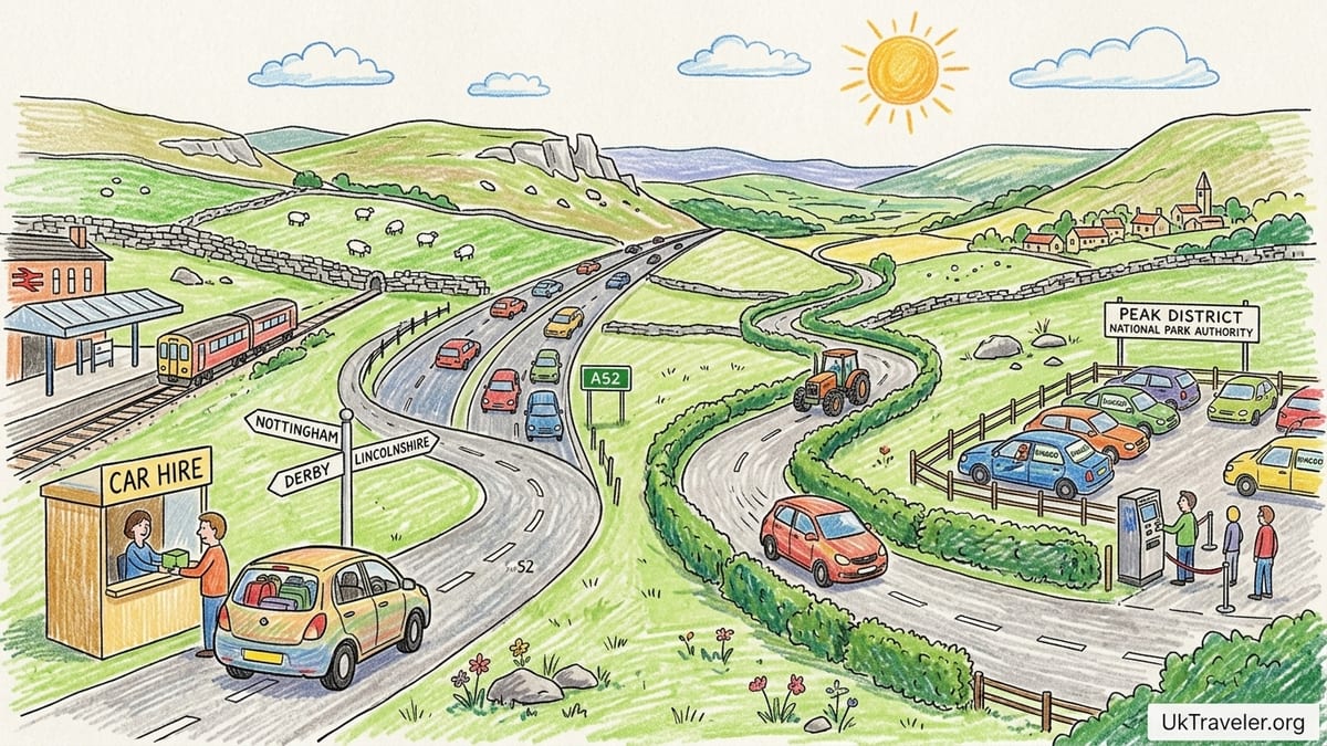
Starting Out: Hiring the Car and Planning the Route
The trip began in Nottingham, which makes practical sense if you are arriving by train. The station area has several city-centre car hire branches within a 10 to 15 minute walk, so I picked up a compact petrol hatchback there rather than at the airport. Nottingham’s one-way system and tram tracks reward a cautious first half hour, but once I had crossed the River Trent and joined the A52 toward Derby, the drive settled into straightforward dual carriageway motoring.
I chose petrol over diesel partly because I knew most of the mileage would be shorter hops rather than long motorway slogs. Fuel prices at the time made supermarket forecourts along the ring roads an obvious choice, and the first fill was on the edge of Nottingham after about 40 minutes of slow city traffic that reminded me why I was grateful to be leaving the inner ring.
On paper, my route looked simple: Nottingham to Derby, then up into the Peak District for two nights, across into rural Derbyshire and on towards Lincolnshire before looping back. What the map could not show was how much time I would spend hunting for parking in busy market towns, or how narrow some unclassified lanes would feel when a farm tractor appeared around a blind bend. I quickly learned that “40 minutes” on a planning app often meant an hour behind the wheel.
I did not need the car every day in the cities. In Nottingham and Derby, it mostly sat in multistorey car parks while I explored on foot or by bus. Out in the Peak District and rural Derbyshire, it was absolutely essential. That contrast became one of the big lessons of the trip.
From Nottingham to Derby: Motorways, Dual Carriageways and Real Driving Times
The first substantial leg was Nottingham to Derby, using the A52 and then cutting onto the A38. Mapping apps suggested around 30 to 35 minutes outside peak hours. In reality, leaving Nottingham at about 4:30 pm on a weekday, it took closer to 50 minutes thanks to congestion approaching both cities and a slow shuffle through roundabouts. The A38 forms part of Derby’s outer ring and is known for heavy traffic at key junctions, which matched my experience as I crawled past queues feeding in from local roads.
Derby itself was not especially enjoyable to drive through. Short distances took longer than expected because of a concentration of traffic lights and steady evening flow in both directions. Finding a central car park was easy enough, but working out which entrances were open and which were permit-only involved an extra lap around the one-way system. The slight relief was that once parked, I did not move the car again until it was time to head north.
Looking back, this entire Nottingham to Derby section would have been better done by train for anyone not continuing directly into the countryside. Fast services between the two cities are frequent, the journey time is usually under 30 minutes, and central parking charges add up quickly. Because I knew I was heading immediately toward the Peak District the next morning, keeping the car made sense. If I had been city-hopping only, I would have left driving out of the plan entirely at this stage.
The first navigation mistake came right at the end of this segment. I missed a right turn near my Derby hotel and the sat-nav tried to recover by routing me through a residential short cut that turned out to be blocked by new bollards. That added 10 minutes of backtracking and an irritated loop back to the main road, and it set a pattern for the kind of small inefficiencies that chip away at road-trip optimism.
Into the Peak District: Car Parks, RingGo and Narrow Lanes
The real point of having the car arrived as I left Derby for the Peak District. I drove up the A38, then west toward Matlock and Bakewell, using a mixture of A-roads and smaller B-roads. The apps predicted around one hour and fifteen minutes to Bakewell. With roadworks on the approach to Matlock and a slower convoy behind a lorry on a twisty section, the journey took just over an hour and forty minutes door to door.
Parking in and around the Peak District required more thought than any other part of the trip. The National Park Authority operates 44 car parks across the park, many of them using pay-and-display with an option to pay by RingGo, a UK-wide pay-by-phone parking app. Official guidance explains that most car parks charge between 9 am and 6 pm and that cashless payment is possible where mobile signal allows. All-day parking at these authority-operated car parks currently costs about £6.60, with shorter stays priced lower. That level of transparency helped, but the rural setting added a complication: at some sites mobile coverage was weak or non-existent, which makes relying entirely on an app risky.
My first morning in the park illustrated the problem. I aimed for a popular walking area not far from Bakewell, planning to arrive around 10:30 am on a Sunday. The small car park was already full, just as the National Park warns can happen at peak times. I circled once, then joined several other cars edging back onto the road and looking for an alternative. The next nearest official car park had space, but here the RingGo option was promoted strongly and the pay-and-display machine was card-only. A brief dip in mobile reception meant the app hung on the payment screen, and a queue built up as drivers shuffled between machine and phones. The entire process of landing a space and paying took nearly 25 minutes, eating into walking time.
Despite that frustration, driving through the Peak District from Bakewell toward Hathersage and around the Hope Valley was the most rewarding motoring of the trip. The posted speed limits and the tight curves make it tempting to rush, but the real joy comes from easing off the accelerator and allowing views of limestone dales, dry-stone walls and sheep-dotted hillsides to unfold. I stopped at one authority car park beside a popular trail, where the clear tariff board matched the published charges and RingGo location codes. It was a reminder that, away from the busiest pinch points, the system works well when you arrive early and have a working phone signal.
Peak District Traffic and Weather: When Driving Became Work
On my second day in the national park, I attempted to do too much. The plan was to start near Bakewell, drive up to a viewpoint above Hathersage, drop into the Hope Valley for a short walk, then continue over a minor road toward a different trailhead by mid-afternoon. The distances on paper were modest, between 10 and 30 miles at a time. I underestimated both the cumulative effect of weekend traffic and the slow average speeds once you left the main A-roads.
Leaving around 9:15 am in dry but overcast weather, it took over 45 minutes to cover a relatively short stretch toward a scenic car park above Hathersage because of steady queues behind cautious drivers and several cyclists on a narrow, hedge-lined road. The car park itself, which had about two dozen spaces and a pay-and-display machine, was already close to full when I arrived just after 10 am. I parked in one of the last bays, paid for four hours at a machine that accepted coins and cards, and mentally patted myself on the back for the timing.
The problem came in the afternoon. I left that car park around 1:30 pm, aiming for another small site closer to a waterfall walk. Navigation apps predicted about 25 minutes. Instead, Sunday traffic thickened around each junction, and I found myself in a slow procession of vehicles squeezing past each other on single-track sections with grass verges and occasional passing places. The drive took nearly 50 minutes, by which time the second car park had already filled. A hand-written note on a board at the entrance confirmed what the queue of idling cars made obvious: there were no spaces available and no overflow. With limited legal roadside options and clear warnings against verge parking, I had to turn around and retreat several miles to a larger pay-and-display car park near a main road.
That detour cost almost an hour, turned a simple day walk into a compressed rush, and underlined one of the National Park’s frequent messages: smaller car parks can fill early, particularly on weekends and in good weather. The irony was that light rain started to fall just after I finally parked up again. On twisting, often shaded roads, wet conditions added an extra layer of concentration, especially as oncoming campervans seemed determined to use every inch of tarmac. By late afternoon, driving felt like work rather than leisure, and I envied the hikers stepping straight onto trains at nearby rural stations.
Lincolnshire Detour: When the Scenic Route Was Not Worth It
After two nights based near Bakewell, I made a deliberate detour east into Lincolnshire. The idea was to contrast the upland scenery with lower, agricultural landscapes and visit a small town that was awkward by public transport. My route ran from Bakewell back toward the A38, then out past Nottingham on a combination of A-roads toward the Lincolnshire border, before swinging onto quieter B-roads and minor lanes.
The first half, using main routes around Nottingham, covered distance efficiently but was not memorable. Journey time from the Bakewell area to the edge of Nottingham was about an hour and twenty minutes, similar to estimates. Once I veered off toward Lincolnshire, progress slowed as heavy goods vehicles and local traffic clumped up behind slow-moving farm machinery. Although the scenery softened into open fields, small villages and flat horizons, it never quite justified the extra hours of driving. I stopped at a supermarket petrol station outside a market town to refuel and grab lunch, grateful for clear pricing and predictable facilities after some of the more improvised stops in the Peaks.
Parking in the Lincolnshire town itself was less stressful than in Derbyshire. A central pay-and-display car park had ample space in mid-afternoon on a weekday, and payment was still possible via card machines without obligatory phone apps. I spent a couple of hours walking around, then realised that the long drive there and back would have been significantly simpler by train, changing once. The town’s main attractions were concentrated within a small area and easily navigable on foot, and there were no remote trailheads that genuinely required a car.
This section taught me that not every scenic line on a map merits a driving detour. In hindsight, I would have traded the Lincolnshire excursion for more time in one or two Peak District valleys, or for an extra urban afternoon in Nottingham or Leicester reached by rail. For a traveler without a very specific reason to drive these rural Lincolnshire roads, the balance between effort and reward was not strong.
Parking Apps, Multistoreys and City-Day Strategy
Back in the cities, parking required a different rhythm. Nottingham, Derby and nearby East Midlands towns increasingly rely on app-based systems such as RingGo or other providers alongside traditional pay-and-display machines. At one large city-centre car park in Nottingham, clearly marked signs indicated that drivers could either buy a ticket at the machine or pay using the location code in the RingGo app. The convenience of extending a stay remotely without returning to the car was helpful when a museum visit overran, but there was a small convenience fee on top of the posted parking charge, something worth factoring into budgets.
On another day, I chose a multistorey car park close to Derby’s shopping streets and noticed that the signage had shifted towards “cashless preferred,” with contactless card and app payments foregrounded. This matched a broader trend in UK parking, where pay-by-phone has gradually supplemented and in some places replaced coins altogether. For international visitors used to feeding meters with cash, having at least one UK-accepted card and a downloaded parking app before arrival is now almost essential in busy areas.
One of my bigger strategic mistakes was keeping the car active on days that would have worked better car-free. In Nottingham I drove from a city-centre hotel to an attraction on the outskirts that was directly served by tram. What looked like a 15-minute hop became a half-hour slog through traffic, followed by a slow search for on-street parking limits and an anxious clock-watching session. I could have saved money and stress by leaving the car in a central car park and simply tapping onto the tram with a contactless card.
By contrast, in Derbyshire villages and on the fringes of the Peak District, there was no realistic public transport alternative. Bus services did exist but were infrequent, often with gaps in the early evening that would have cut short a walk or dinner. In those places the flexibility of a car outweighed the irritation of parking, and the cost of an all-day national park car park fee felt reasonable compared with the freedom to start and finish walks where I wished.
Weather, Driving Conditions and Navigation Errors
The East Midlands gave me a full range of weather over the course of the road trip. Dry, bright mornings in Nottingham and Derby made the motorways and dual carriageways straightforward. Visibility was good and spray minimal, and I could sit at legal speeds for sustained stretches. Once in the Peak District, though, overcast skies thickened into drizzle and intermittent rain, and that changed the character of the driving significantly.
On exposed sections above the Hope Valley, low cloud and mist reduced visibility, and damp road surfaces demanded slower cornering and longer braking distances. Passing slower vehicles became less attractive on twisty stretches, so convoys formed behind cautious drivers. Some lanes funneled between stone walls and overhanging trees, making it clear why advisory speeds were lower than the posted speed limit. In these conditions, the car’s headlights and windscreen wipers did as much to keep me relaxed as any navigation app.
I made several navigational missteps that compounded the weather challenges. One involved trusting the sat-nav when it tried to shortcut between two villages along what looked like a minor lane. After turning off, I found the road progressively narrowing until grass grew between the tyre tracks. A sharp dip, muddy even in summer, made me question whether the car would bottom out. Reversing back to a passing place took several patient minutes and co-operation with another driver, while light rain continued to fall. That experience persuaded me to give more weight to local brown tourist signs and traditional road markings rather than blindly accepting the most direct GPS route.
Another mistake was relying on a single navigation app without saving offline maps. In a couple of valleys, the phone lost data signal just as I approached unsigned junctions. Without a stored map, the app froze on outdated information. I ended up taking a wrong turn, climbing an unnecessary hill and returning to the same T-junction from which I had started 15 minutes earlier. It was a harmless error, but on a tight schedule it introduced stress. For anyone planning similar rural driving, preloading offline maps and carrying a simple paper map remains sensible insurance against patchy coverage.
The Itinerary I Would Use Next Time
Replaying the journey with the benefit of hindsight, I would tighten the route and cut back on both city driving and over-ambitious day plans. The trip as driven began in Nottingham, ran to Derby, then into the Peak District for two nights based near Bakewell, continued east into Lincolnshire for a night, and finally returned to Nottingham. That meant four different overnight bases for a relatively modest geographical area, and it created unnecessary packing and parking cycles.
Next time, I would keep the overnight bases to three at most, possibly two. A more streamlined version might look like this. First, start in Nottingham, but do not pick up the car until leaving the city. Spend at least one full day and night there car-free, using trams and buses. Second, collect a rental car on the edge of Nottingham and drive directly into the Peak District, choosing one central base such as the Bakewell area or another well-connected village for three or four nights. From that single base, day-trip by car to nearby valleys, viewpoints and walks, accepting that on popular weekend days an early start is the only way to secure parking at smaller car parks.
Third, finish with either a night in Derby or another East Midlands city, again dropping the car on arrival and relying on foot and public transport within the urban core. This eliminates the Lincolnshire driving detour, which in my case did not offer enough to justify the extra time at the wheel. It also reduces backtracking, since you are not repeatedly re-entering the same congested sections of ring road from different directions.
Alongside this structural change, I would consciously under-schedule the Peak District days. Instead of trying to fit two or three separate walks into one Sunday, I would choose a single valley, book parking in mind for one main car park, and treat any second stop as optional. Planning around the reality that all-day National Park car park charges are now in the mid-single-figure pound range, with official guidance currently quoting £6.60 for a full day, helps frame expectations and prevents frustration at paying twice for rushed half days. Leaving generous margins also makes bad weather or small navigation errors easier to absorb.
Finally, I would ensure at least one of the overnight bases is walking distance from a rail station that connects easily back to Nottingham, Derby or Leicester. That way, if I wanted to add a day trip without the car, I could do so spontaneously, using the station as a release valve from road traffic without giving up the flexibility of having a vehicle for rural days.
FAQ
Q1. Do I really need a car for an East Midlands trip that includes the Peak District?
For city centres such as Nottingham, Derby or Leicester, you can get by on trains, trams and buses, but for reaching most Peak District trailheads and smaller Derbyshire villages a car is very helpful. I found the car unnecessary and occasionally stressful in cities, yet essential once I was aiming for rural car parks away from main bus routes.
Q2. How much should I budget for parking in the Peak District?
The Peak District National Park Authority currently lists all-day parking at its pay-and-display car parks at about £6.60, with lower tariffs for shorter stays. Not every car park is run by the Authority, so charges may differ at local council or private sites, but planning for a mid-single-figure pound amount per full day is realistic.
Q3. Is RingGo or another parking app required everywhere?
No. In my experience, many National Park car parks and city multistoreys still offered card or coin pay-and-display machines as well as RingGo or similar apps. However, several locations strongly encouraged or required cashless payment, and having at least one UK-recognised parking app installed before arrival made life noticeably easier.
Q4. How early do Peak District car parks fill up?
At popular spots on weekends and in school holidays, smaller rural car parks can be full by mid-morning. On one Sunday I arrived just after 10 am to find a limited car park already at capacity and had to divert to a larger, less convenient site. For the busiest locations, aiming to arrive between 8 am and 9 am is a safer strategy.
Q5. What are real driving times like compared with map estimates?
On dual carriageways between cities, my actual times were usually 10 to 20 minutes longer than optimistic off-peak estimates. In the Peak District, minor roads with tight bends, slow convoys behind cautious drivers and photo stops meant that a “30 minute” leg often took closer to 45 minutes or more. Treat any estimate as a minimum, not a promise.
Q6. Are the roads difficult for drivers used to motorways?
The approach between Nottingham, Derby and other East Midlands cities is mostly straightforward A-roads and motorways. Difficulty increases on Peak District lanes, where narrow carriageways, stone walls, overhanging trees and blind bends demand slower speeds and confident handling. If you are used only to wide dual carriageways, allow extra time and take the first day in the hills gently.
Q7. How did weather affect the driving?
Rain and low cloud in the Peak District turned otherwise pleasant drives into more concentrated work. Wet, shaded roads reduced grip, and visibility dipped on higher passes. In fine weather, the same stretches were enjoyable and scenic. When planning, it helps to keep a flexible schedule so that the longest or most exposed drives do not fall on the worst-weather days.
Q8. Is it better to stay in one Peak District base or move around?
After trying multiple overnight stops, I would now choose one central base for several nights in the Peak District. This reduces packing and parking stress and allows day trips in different directions without constantly relocating the car. A single base near towns like Bakewell or similar hubs works well for reaching a variety of valleys and viewpoints.
Q9. Which parts of the route would you do by train next time?
I would take the train between major cities such as Nottingham, Derby and Leicester, and only hire a car for the rural section centred on the Peak District. City-to-city legs felt inefficient by car because of traffic, parking fees and one-way systems, while the countryside segments genuinely benefited from the flexibility of driving.
Q10. What was your biggest planning mistake on this East Midlands road trip?
The main error was trying to fit too many separate drives and walks into a single day in the Peak District, coupled with choosing an extra overnight stop in Lincolnshire that did not add enough to justify the extra kilometres. Simplifying the route, reducing bases and allowing more slack in the schedule would produce a far more relaxed and rewarding trip.